
I am at the second stage of my road trip planning. In my last post about this subject (Planning Road Trip 2014 – How you Plan a Road Trip), I mention my intentions of researching or knowing some apps that could help me to plan our itinerary. All the applications that I will be mentioning or using I found them at the apple store because I will be using my I pad. I am pretty sure that most of the apps also come for android users.
I love the fact of being able to have a device that you can carry around and it is multi-usable. I love the fact that you can have all the maps, attraction lists, metro maps and information, in other words your everything with you at all times y one same place! Amazing!
Ok, so I first started with Washington DC. I went to the App Store, look through the options. First I started exploring the free applications that have information about the city, maps and attractions. I got CityBot DC and City Walks for Washington DC. I found out later that this two apps comes for many major cities in US, including NY City. After playing with this applications for a while, my conclusion was:
 CityBot – Gives you good information but constructing an itinerary is a little hard, at least was for me. I decided to used it as reference for prices of places and for research of places.
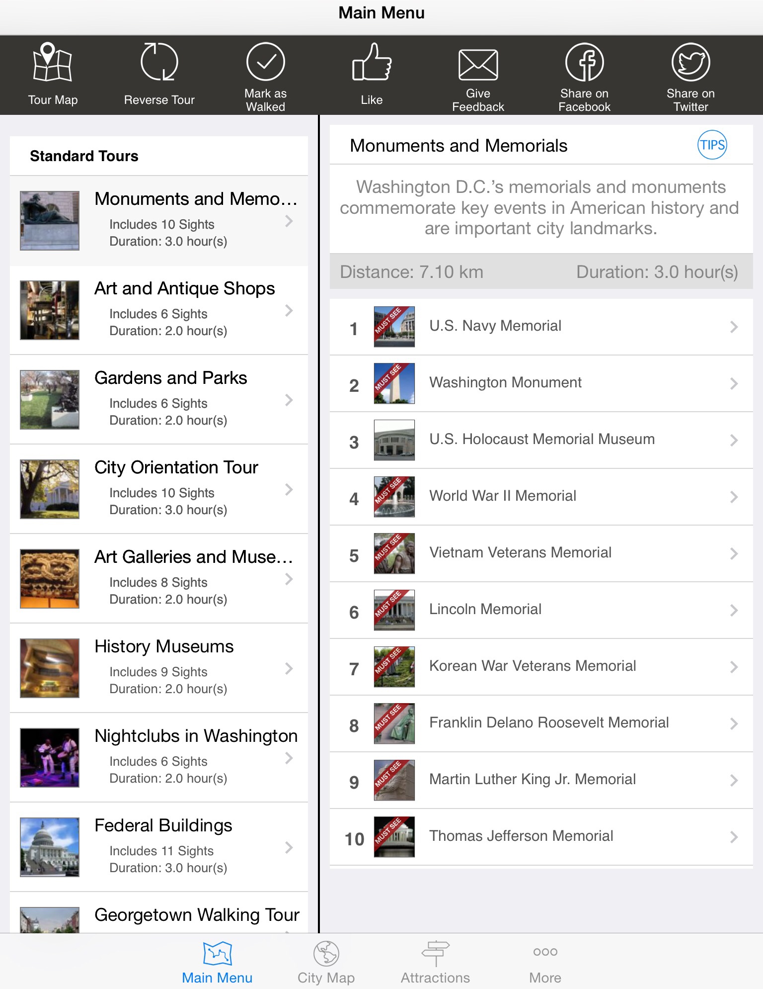
You can also make your own itinerary from scratch or use the standard tours that they suggested mixing them in a way that works for you. That is what I did, I created my own tours based on the ones that they suggest but accommodating it to our needs. It also will give a map, for you to arrange your tour and stops in the order that is more convenient for you. Here is one of the tours that I made for Saturday May 14.


Here is another App, this one I found for free (MX for Metro in DC). I think this one is great, comes with a metro map of the city and you can enter the metro station from where your departing and where you want to go, it will show you which metro to take and the time of your ride. For anyone that it’s not familiar with the metro system in DC its a good start. I eventually will let you know if it really works.
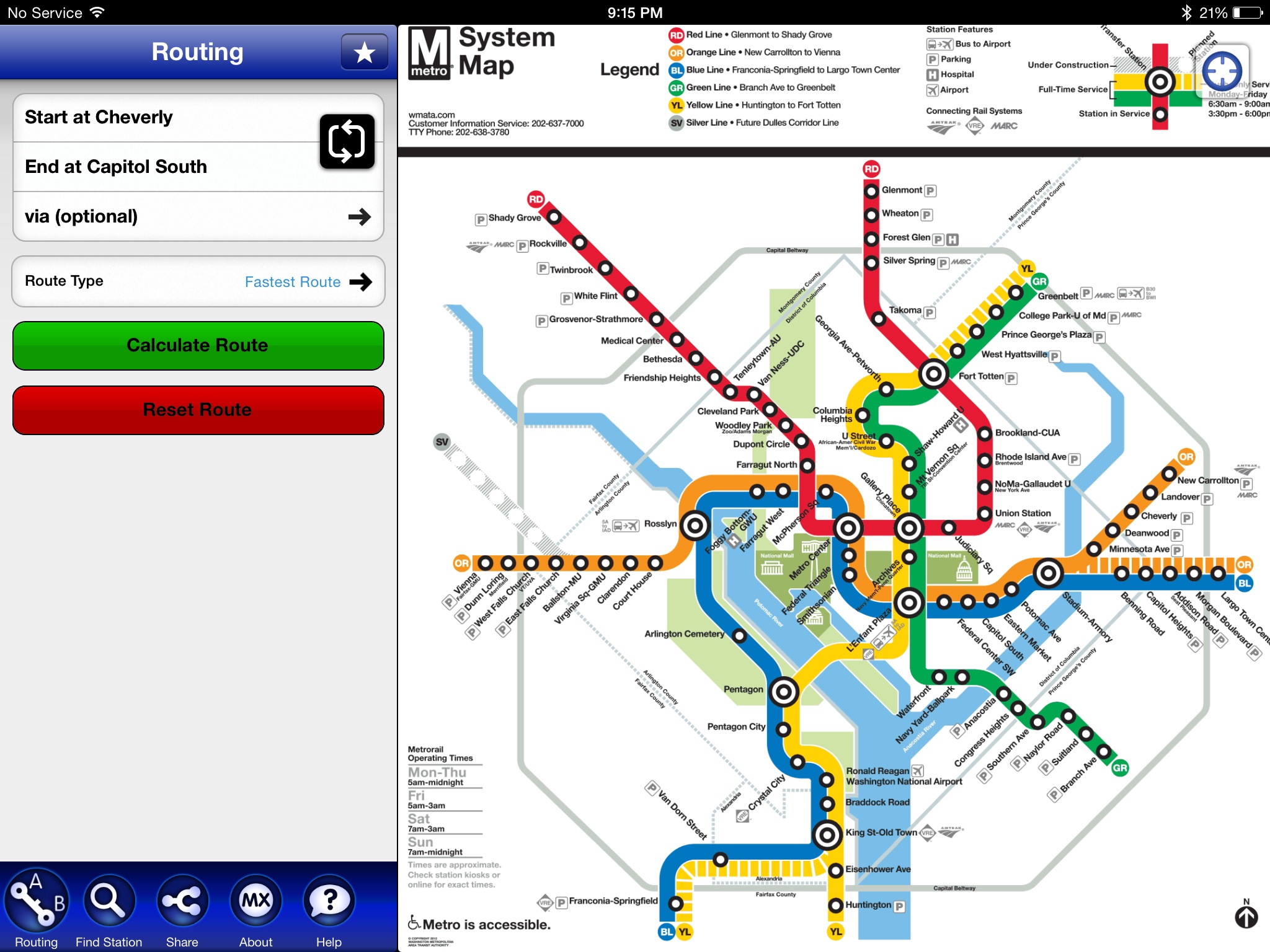
For New York I used the same applications for the City of NY. For the metro system in NY, I will be using the App NY Subway. This one is a little bit more confusing but basically works the same way as the DC one. Of course, the metro system in NY is a lot more complicated than in DC. Here is a pic so you can have an idea.


I got you a closer look, in this map you can touch one of the stations (round/square numbers or letters) and it will open asking if this is where you want to come from or go to. Then you pick up the other end of your trip and it will trace your route, giving you the information of how many stations you will pass and the time of your ride. I think it will be very helpful too.
Well this is all I found out on my research, I hope this will be helpful for you and me. 🙂
Now I am working on my options for coming back home and a plan B if we decided not to go up to the Niagara Falls.
Until then,
xamlinnette 🙂

This is a greaat blog